Across the Iron Range: Biking the Mesabi Trail

Last year, I planned a three-day bikepacking trip on the Mesabi Trail in Northeastern Minnesota. Torrential rains created major sinkholes along the trail, forcing us to cancel the trip. The trail remained on my radar, and planning began in early 2026—this time, the group wanted to make it a five-day trip, with out-and-back segments each day.
Fast forward to late July 2026, and I thought the Mesabi Trail would be an elusive trip I’d never get to experience. This time it wasn’t rain; it was forest fires and smoke. Fires in Canada and the Boundary Waters were causing unhealthy air quality and evacuation alerts in Ely (the eastern end of the Mesabi Trail). I monitored conditions daily; local rains helped firefighters contain the flames, and air quality improved. In fact, the air quality improved to the point that it was better up north than in Chicago. The trip was a go!
The 411 on the Mesabi Trail
The Mesabi Trail spans 160 miles from Grand Rapids, MN, and the Mississippi River in the west to Ely, MN, and the Boundary Waters in the east. The trail is paved asphalt, except for a short gravel section through the Darwin S. Myers Wildlife Management Area near Embarrass, MN. There are also a few gaps in the trail, including one that requires riding on HWY 135, which is NOT recommended.
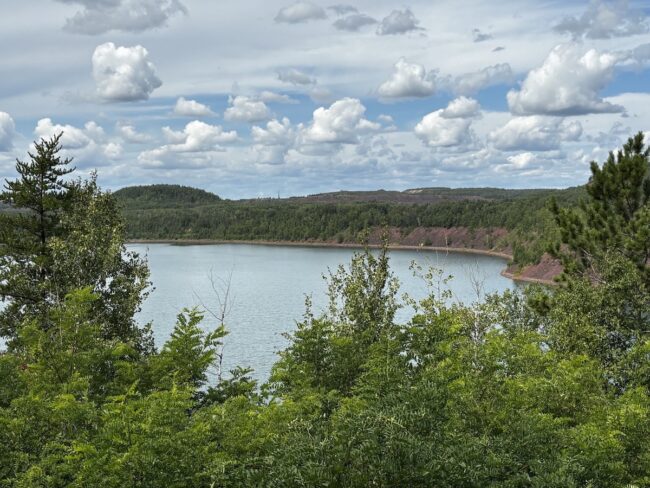
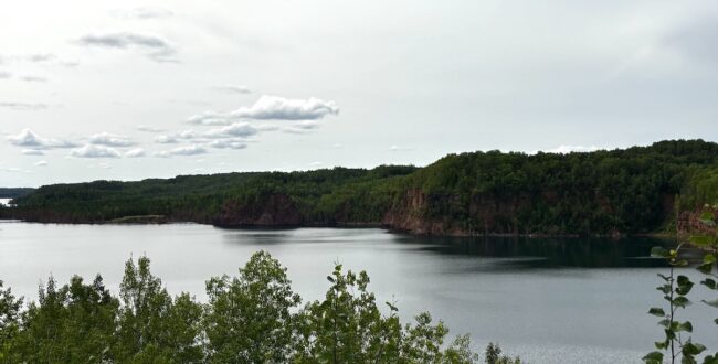
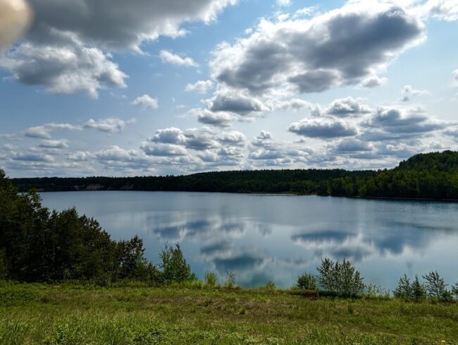
Minnesota’s motto is “Land of 10,000 Lakes,” and you will definitely see water as you meander through the Iron Range. You’ll see remnants of abandoned mines, as well as working mines. The old mine pits have become beautiful lakes, with red iron ore tailings piled high on their banks and no vegetation.
Trailhead access and parking are plentiful across the 28 communities along the trail. Food, water, and restrooms are sometimes scarce, so plan ahead and never pass up a chance to use the porta-potty.
Wheel Passes are required to ride the trail. You can buy them online or from several vendors in each town. I highly recommend saving time and purchasing online. Even though we were never asked to show our trail passes, I don’t mind supporting trail maintenance. There is a $10 Limited pass or a $20 annual pass.
A Mesabi Shuttle Service is available for pickup or drop-offs. I tried to arrange for a drop-off to avoid one day of an out-and-back, but they were booked up. If you need a shuttle, I suggest contacting them well in advance.
Several aspects of the trail surprised me, such as:
- the lack of wildlife along the trail—but continue reading to learn about some close encounters of the furry kind.
- the trail was hilly, with a few double-digit grades.
- riding the trail on the weekend and weekdays with very few cyclists. There were a lot of e-bikes on the trail, including fat tire and townie-type bikes. Pedal bikes ranged from road to gravel to recreation. Even our group of four riders brought very different bikes and tire widths. Personally, I was very happy with my choice of 45mm gravel tires to reduce the jarring, bumpy trail.
- ATV and snowmobile trails run adjacent to or sometimes overlap the Mesabi. Mountain biking is very popular up north, with an abundance of trails to explore.
Day 1 – Grand Rapids to Taconite and back
Miles: 21.64
Elevation Gain: 794 ft.

After sitting in the car all day, we made a last-minute decision to take a short ride, thereby reducing the mileage for the next day.
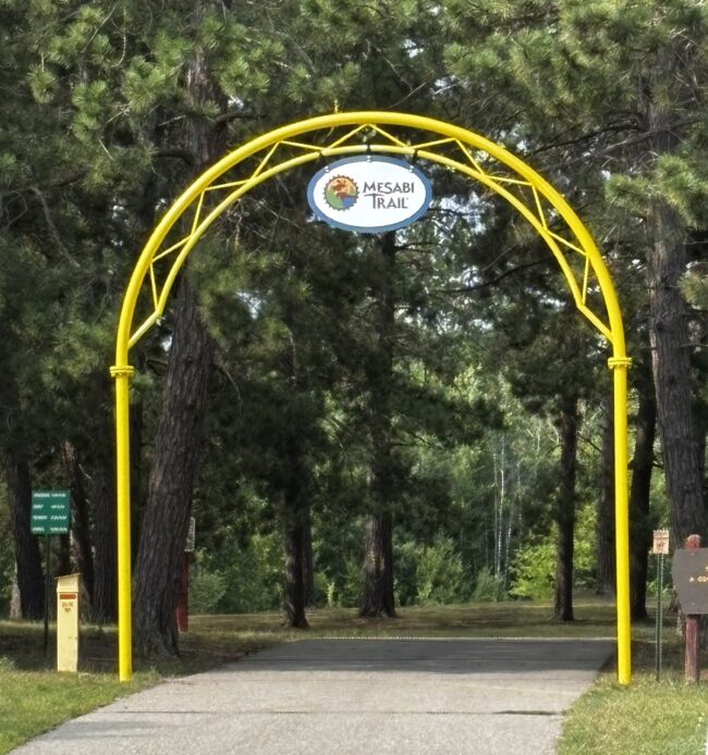
The western end of the trail starts at the Itasca County Fairgrounds and Campgrounds in Grand Rapids (Minnesota, not Michigan; be careful when making hotel reservations). Ample parking is available, and the general store carries paper trail maps. The yellow arch with the Mesabi sign marks the trailhead. Get ready to climb right out of the gate on a winding path.
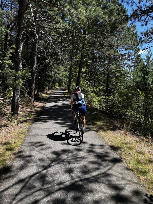
Don’t be fooled into thinking that because the path is paved, it will be a smooth ride. Tree roots breaking through the asphalt and expansion joints make for a bumpy ride. I was certainly glad I was riding my Salsa Cutthroat with 45mm tubeless tires.
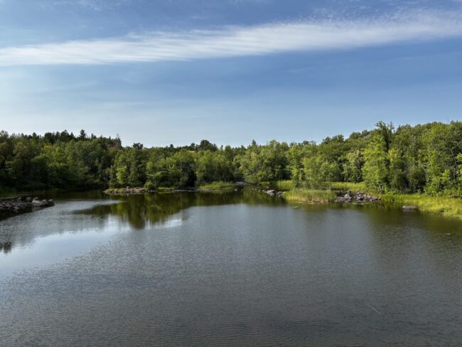
The Prairie River was the first body of water we crossed after leaving Grand Rapids.
We crossed the Prairie River, which flows south to join the Mississippi. It is also where iron ore was first discovered on the western range in 1866. Other sights included a large garter snake and fresh black bear scat.
As we approached the small town of Taconite, we passed abandoned railroad tracks. They were just the first of many we’d come across along the trail. At Taconite, we turned around and headed back to Grand Rapids. After a quick shower at the hotel, we had dinner at Sammy’s, a small chain restaurant in Grand Rapids, where I had my first of many cups of wild rice soup that week. Until that night, I wasn’t aware that Minnesota was known for growing wild rice. During the trip, I’d get to taste-test a variety of wild rice soups and burgers. Yes, wild rice vegetarian burgers. Yummy!!!
Day 2 – Taconite to Hibbing and back
Miles: 62.33
Elevation Gain: 2,208 ft

We got up in the morning and drove to Taconite. Today we rode to Hibbing and back. It was a long day, a metric century: today, more fresh bear scat. No sightings of a black bear, but they were out there. We did get to see a red-tailed hawk and a young buck whose antlers were partially grown in.
Today’s segment took us past the Morton Mine Pit and the Hawkins Mine (operated from 1902-1962).
A recurring theme was that the signage connecting the trail through these small towns needs improvement. Sometimes there were arrows on the pavement (often worn away and barely legible), other times it was a green-and-white bicycle route sign, and sometimes there was nothing at all. Even with two of us watching for signs, we’d find ourselves riding in circles. But once we figured it out, the return ride was much quicker.
When we arrived in Hibbing, one of the larger towns along the trail, it was only a few blocks to the heart of town. A quick search on Google Maps, and we decided to have lunch at Sportsmen’s on Howard St, the main drag through town. The meal did not disappoint, and the French fries were delicious. Refueled, we set out to make our way back to our cars in Taconite.
We made the two-hour drive east to Ely, where we joined two riders from our group for three more days of cycling. We stayed at the Adventure Inn, a quaint hotel. Half the guests were firefighters in town battling the Boundary Waters fires. Everywhere we went in Ely, businesses displayed signs or banners thanking the firefighters.
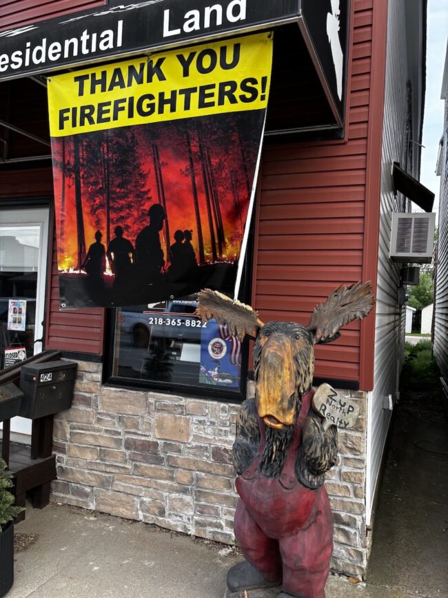
Businesses throughout Ely expressed their gratitude to the firefighters helping to extinguish area forest fires.
Dinner was a short walk to the Frisky Otter, and the first of several ice cream stops that week was at the Log Cabin Coffee & Ice Cream shop, across from the hotel.
Day 3 – Ely to Tower and back
Miles: 56.41
Elevation Gain: 2,556

Today was by far the best day on the trail. Not only was it picturesque, but the trail was newly paved and smooth. Our hotel didn’t offer breakfast, so we biked to Brainstorm Bakery. They serve fresh-baked pastries, overnight oatmeal, coffee, and the best Crapola cookie. From there, we continued to the east end of the Mesabi Trail and headed west toward Tower.
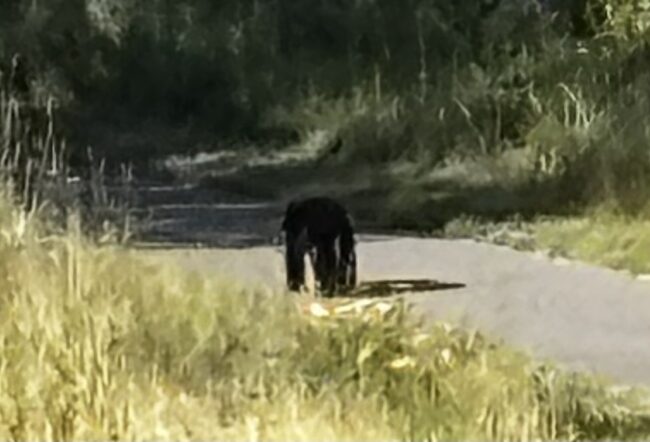
We got about 10 miles into our ride when I spotted a black bear on the trail. It was a juvenile getting his fill of berries along the trail. Yelling was enough to scare him and make him scamper off into the woods. We didn’t get more than two miles and another black bear sighting. This time it was a mama with two adorable cubs. But from all my years of hiking and camping, you never ever get between a mama and her babies. Again, once all three of them scampered into the woods together, we continued. That’s not to say we weren’t on high alert and cautious, not wanting to come around a blind corner and startle a bear.
Our first stop was at Eagles Nest for a porta-potty break and snacks. I struck up a conversation with a woman heading to the Boundary Waters to canoe. She had been coming up to Ely for the past 17 years.
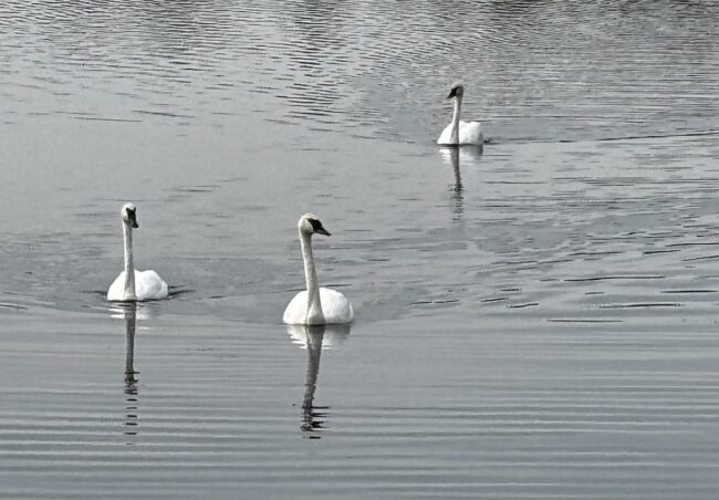
Next stop was just outside of Soudan. We stopped a woman biking in the opposite direction and asked for suggestions on where to go. She recommended taking the loop trail to Hoodoo Point, warning us of a steep climb, but it was definitely worth the effort. On the loop, we had our first of many trumpeter swan sightings.
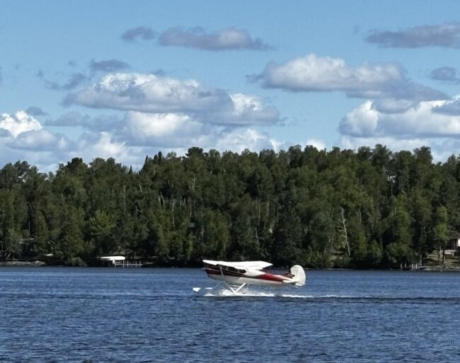
Continuing, we arrived at a small municipal airport next to Lake Vermillion. Adjacent to the airport were seaplane docks. As luck would have it, two pilots were waiting to take off, heading north to check on their cabin that may have burned down in the wildfires. After chatting for a while, we watched them taxi on the lake before taking off. They did a flyby overhead, their way of saying goodbye.
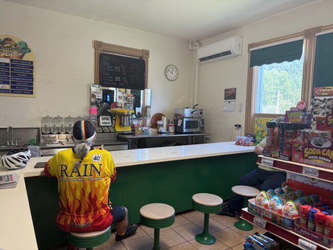
We found a bar/restaurant in Tower for lunch and then headed back to Ely. The woman who gave us directions and the two pilots both said to stop at the SOS (Soudan’s Only Store) for the best ice cream. They had us at “ice cream,” so of course we stopped. It felt like going back to the 50s, with the old soda-fountain shops. The folks were super friendly—yes, Minnesota Nice—and we chatted with them while enjoying some of the best ice cream, which was actually from Wisconsin.
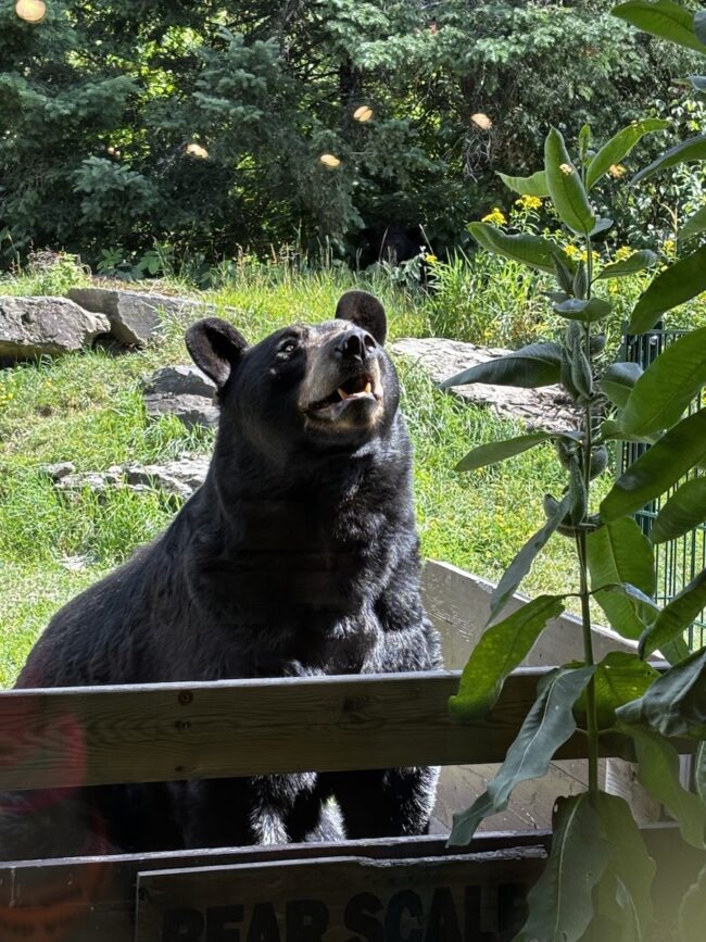
As we neared Ely, a group of cyclists told us there were cubs in a tree 100 yards up the trail, but unfortunately we never saw them. We stopped at the American Bear Center on the outskirts of Ely and took a behind-the-scenes tour of the facility, which is home to three bears that could not be rehabilitated and released back into the wild. They have several acres of habitat to enjoy and are well cared for. Ely is also home to the International Wolf Center, but it was closed that day.
Dinner was at the Grand Ely Lodge Resort, overlooking Shagawa Lake. After dinner, we went across the street to look at some artifacts from the Pioneer Mine. As we were walking around, an older gentleman materialized out of nowhere. He started talking to us and turned out to be a former Pioneer miner and now volunteers at the museum. He offered to open the museum just for us, then held us “captive” for over an hour as he told us the history of the mine.
Day 4 – Mountain Iron to Embarrass and back
Miles: 66
Elevation Gain: 2,520 ft
In the morning, we drove to Mountain Iron, picked up the trail, and headed east toward the town of Embarrass. We skipped the section from Tower to Embarrass because it required riding on Hwy 135, which is very busy, has no shoulder, and is warned against by all the websites.
Today we’d experience a little of everything: bumpy asphalt, floating bridges, and gravel roads. Even with four of us looking for signs and pavement markings, it was a bit convoluted to get through town and stay on the trail. Again, the ride back was much easier.
Not long into our ride, the trail took us across Minnesota’s tallest bridge, offering spectacular views. The Thomas Rukavina Memorial Bridge (aka Virginia High Bridge) spans the former Rouchleau Mine Pit. The bridge is 204 feet above the ground and stretches 1,125 feet from bank to bank, with Rouchleau Lake below.
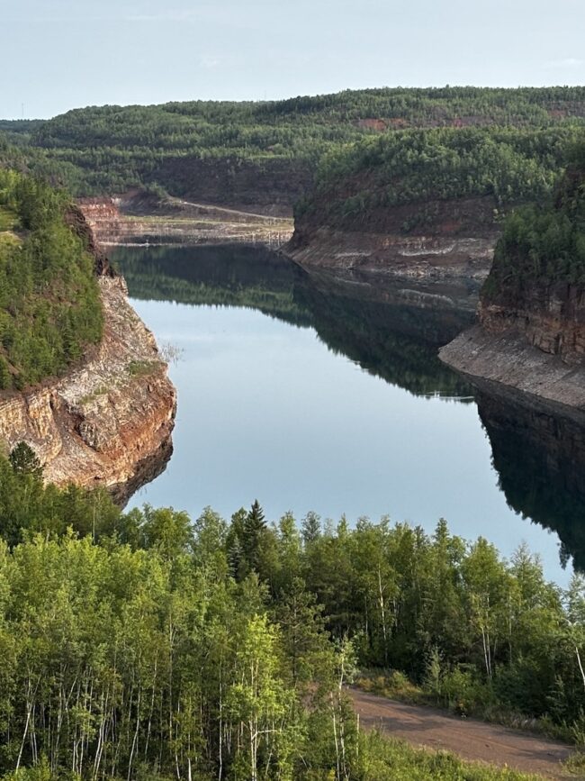
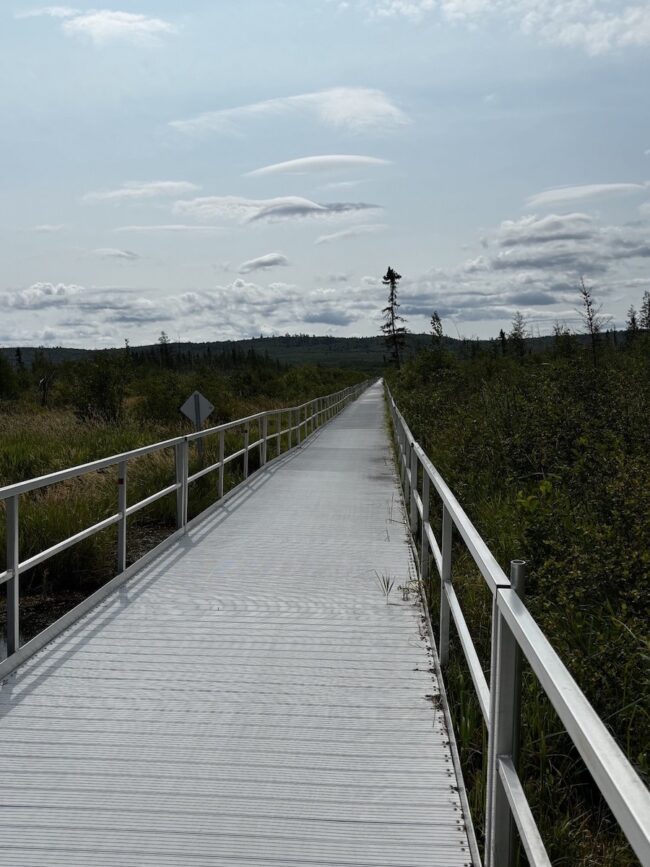
Continuing, we came across the third and longest floating bridge on the Mesabi Trail. This one, just south of Embarrass, is ¾ mile long and spans a wetlands area in the Superior National Forest. The water wasn’t high enough to wet the bridge, so it wasn’t slippery, but the sound of the bikes rolling over the metal was deafening.
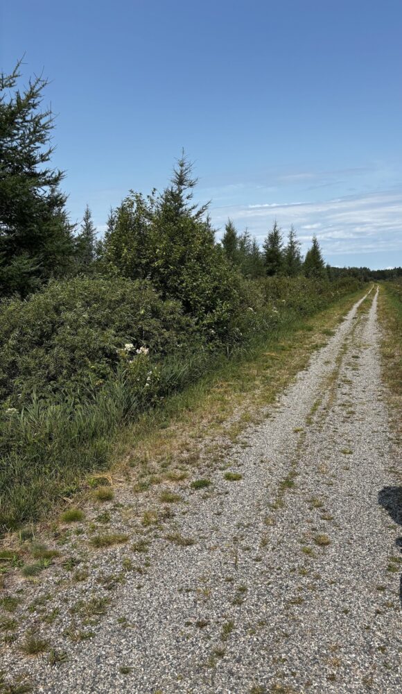
Next, we came across a ¾ mile gravel road. Did I mention we had a little bit of everything today? It was fairly hard-packed with a few soft areas. We planned for the road to end right at the outskirts of Embarrass and to grab lunch somewhere in town. But once we got to the end of the gravel road, there was nothing. Checking Google Maps, it was at least another 3+ miles into town with no guarantees of a place for lunch.
Starving, we headed back over the gravel road and the floating bridge, stopping at a golf course for lunch. The back patio overlooked a beautiful lake, obviously created from an abandoned pit mine.
Hydrated and fueled, we finished the return ride to Mountain Iron—dinner at Cazadores Mexican Restaurant and a walk around Locomotive Park overlooking the old mine pit, a locomotive, and other large machinery used at the mine.
Day 5 – Hibbing to just short of Mountain Iron and back
Miles: 38.28
Elevation Gain: 1,371 ft
Today was the final segment needed to complete the Mesabi Trail and probably the bumpiest and least scenic section.
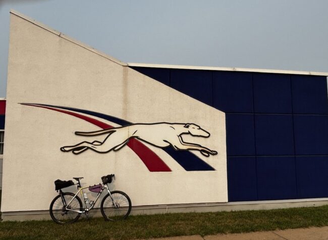
We left Mountain Iron after breakfast and drove to Hibbing, about 20 minutes away. Once there, we picked up the trail next to the Greyhound Bus Museum. Heading east for a few miles, we took a spur trail toward the Minnesota Discovery Center and the Iron Man statue in Chisholm. At the Discovery Center, we crossed a busy highway to view the 85-foot-tall Iron Man, the third-largest freestanding memorial in the U.S. and a tribute to steel miners.
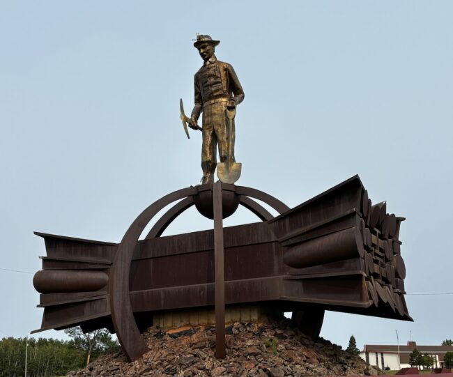
After a few pictures at the statue, we took the spur back to the main Mesabi Trail, heading east through the town of Buhl. We stopped at a lake with a small beach for a few minutes to take a break from the bumpy trail. As we made our way toward Mountain Iron, the trail continued to deteriorate, becoming bumpier and featuring short gravel sections. Finally, we decided to turn around just short of reaching Mountain Iron.
Once back in Hibbing, we grabbed lunch again at the Sportsmen’s Restaurant and then walked around town, stopping at a local bike shop. Bob Dylan’s childhood home wasn’t too far to walk, so we killed some time before checking into our hotel rooms and went to take a look. Honestly, it wasn’t any great shakes. Taking a different route back to the cars, we walked by the Hibbing Curling Club.
Dinner that night was at Sammy’s, the same chain as in Grand Rapids. Then early to bed, as we all had a long drive home the next day.
Conclusion:
I’m happy to finally check the Mesabi Trail off my list of places to ride. However, if I do it again, I’d skip some of the less scenic and less maintained sections and spend more time riding between Tower and Ely. In addition, I’d like to explore several of the state parks, including Bear Head Lake, and spend time hiking and kayaking. There are also countless museums and historical sites to visit.
It is sad to see the small towns along the trail struggling to stay alive. They once had a booming economy, but have fallen on hard times since most of the mines have closed. Many stores along the town’s Main St. are now vacant, and more are hanging on by a thread.
My hope is that tourism can be a lifeline for these towns. Northern Minnesota has so much to offer: vast tracts of untouched forest, 10,000 lakes, great food, and locals who embody Minnesota Nice.
Final Stats
5 days riding segments out and back
245 miles
9,459 feet of elevation gain
Gear Used
Panaracer Gravelking X1 Plus + 45c
SaltStick Tablets and FastChews
Mesabi Trail Resources
Sheri Rosenbaum regularly contributes articles and reviews products for RBR. She’s an avid recreational roadie who lives in the Chicago area and a major advocate for women’s cycling, serving on the board of directors and volunteering with the Dare2tri Paratriathlon Club. Click to read Sheri’s full bio or visit her web site sunflowersandpedals.com.


Thanks Sheri, great recap! Appreciate the insight!
Barry, glad you enjoyed the article.
This is a great summary of your trip. Thank you for inspiration to give this trail a try!
Jerry Brick.
Jerry, let me know if you ride it and what your thoughts are.