
By Stan Purdum
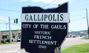
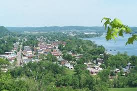
My wife and I recently moved from New Jersey to Ohio, to a town that is essentially a “desert” as far a bicycle support services are concerned. The town is Gallipolis (pronounced GAL-a-pol-LEES), a community of about 3,500 people right on the banks of the Ohio River in the southeast corner of the state. We really like it here, and our daughter, son-in-law and granddaughter live nearby. (By the way, I first visited Gallipolis on a bicycle journey, years before I had any other reason to be here; see my article “Day of Adventure on the Bike.”)
Within days of arrival, simply by paying attention while driving to local roads as a far as paved shoulders and traffic volume were concerned. I identified a couple of possible routes for cycling, and when I later pedaled them, they worked well. The town also has a rail-trail looping through it, and about six miles of it is paved. I found it an obvious place to start riding, and I often use it as a connector to rides farther out.
Looking for some additional routes, I googled bicycle clubs in Gallia County, of which Gallipolis is the seat, and that’s when I got my first clue that the place is a bicycle desert, for there were no clubs. I also searched for clubs in Point Pleasant, the small sister town across the river in West Virginia (there’s a bridge between the two communities). Turns out there are no clubs on either side that have published routes. Google did turn up one guy on Strava who rides trails and is interested in finding others to join a virtual Strava club. It also found a group that has developed a bike-and-pedestrian trail through downtown Point Pleasant, but that appears to be the limit of their identified routes.
A further search found what sounded like a local club. An internet list of bike clubs in Ohio had something called the French City Bicycle Club. “The French City” is a nickname for Gallipolis because it was first settled in 1790 by a group of 500 immigrants from France, and Gallipolis, in Latin, means “City of the Gauls.” This club had no website I could check, but the list included an address for the club — just four doors down the street from my house! So I walked to that house, and the lady who answered my knock said no bike club was there, but then she remembered that a former owner of that home had been a cyclist; unfortunately, he was now deceased.
At least I got to meet one of my neighbors.
Searching on “bike routes in Gallia County,” I found some MapMyRide routes, but they were mostly short, in-town jaunts that ran along the streets I regularly drive to handle daily errands. The single longer ride was one I’d already found on my own.
I then ran a search for local bicycle shops, which in some locations, are a good source for established rides. The only thing that search turned up, however, was Walmart. The nearest actual bike shops are about 40 miles away, too far to likely know about rides in the Gallipolis area. Fortunately, I’m able to handle most bike maintenance on my own.
The absence of established routes does not worry me. My cognitive map works well, and I have no trouble stringing streets and roads together in my head to form cycling routes. (See my article “The GPS in Your Head” and also Part 2 of that piece.)
The biggest help I’ve found in route finding is a county map — on paper, not screen. I got mine at no cost from the local Chamber of Commerce, though, in Ohio at least, they are often also available from the county engineer’s office. Some of the routes that look likely on the map, I simply ride to determine if they are suitable for biking. Others, I first explore by car (in one case, finding one of the hilliest roads I’ve ever encountered).
I now have one rural ride I think of as a “trunk route”; there are numerous roads leading off of it, and as time and energy permit, I pedal some of these, always knowing about where I am because of proximity to the trunk. I sometime also use the “maps” function on my phone to peruse a side road before committing myself to it. Occasionally, when a side road proves unsuitable — the pavement turns to gravel (I’m riding a road bike) or too many dogs are running loose — I simply turn around. But most of the time, these trips off the trunk add to my route options.
The other thing that proved helpful is a set of 19 maps, collectively covering all of Ohio with roads marked for cycling according to traffic counts. This set was produced by the bicycle division of the Ohio Department of Transportation sometime in the last century, probably the 1980s, and, as far as I’ve been able to find out, they’ve never been updated or reprinted, though there are now some statewide resources online from ODOT. I had the old paper set in my files from living elsewhere in Ohio previously. The map that includes Gallia County isn’t up to date — one of the newer major roads isn’t even on that map, and in some cases, the traffic counts have changed, rendering some of the roads marked as suitable as no longer so. But still, there’s enough valid information on the map to help me plan routes.
And really, finding new places to ride is all part of the bike adventure, isn’t it?!
Looking at maps is truly the key. We moved 6 years ago and had to discover a whole new set of routes. The first thing we did was pull out county maps and an old set of bike maps (by county) that the state had put out many years ago. Within a few weeks we had a collection of good rides. I then found a couple of local ride groups and in discussions with them realized that many of these riders didn’t know the road names, didn’t know how different roads connected, and only rode the same route repeatedly. They never looked at maps! And one of our local counties has an easily understood road numbering scheme that many riders don’t understand or didn’t realize. As “the new guy” I was explaining things to them. Study the maps and all will be revealed!
Ride with GPS recently announced a Heat Map function that shows roads being used by riders who post rides publicly in RwGPS. I went to your new town and it shows a few roads that are being traveled by cyclists. Just go to the route planner function and click on the heat map.
Don’t overlook those bike shops 40 miles away. If they have group rides it’s possible some of the routes head in your direction and can be ‘reverse engineered.’
Strava has had a global heat map for years. It allows one to see where other riders (at least those who use Strava) ride in a particular area. There is color coding that highlights the most used roads (they are “hotter”). Not sure Mr. Purdum needs this, but others might want to know it is available. You need to have a Strava account to access it in detail but it can be useful when you get to a new area.
https://www.strava.com/heatmap
It would be a good idea check the roads out on a map, perhaps in person, some people are more comfortable with more traffic than others and may ride a road all the time that someone else would not enjoy very much. Or they may ride it early in the morning etc. when traffic volume is lower.
With a Ride with GPS account, one can also find other rides people have planned in your area (either to load on their bike computer, or to share with riding buddies.). I don’t know that many people who use Ride with GPS to record the rides they have done, so I don’t know how effective their new heat map will be. But when logged in you can search for rides for which cyclists in your area created maps. Coverage will be hit or miss depending on how many users there are in an area. Where I lived in SW Ohio there were tons of routes, here in deep south Texas, not that many.
You don’t need to record your own rides to use these features, just have an account. I believe both services offer some level of free access. The maps can be accessed on regular computer etc. As an aside, you don’t need a GPS bike computer to track your rides with Strava, they have a phone app that works well. Ride with GPS also has an app.
Thanks for the helpful suggestions.
My article has also led to an introduction to a local cyclist.